


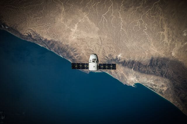
Space data might sound like something reserved for scientists, governments, and aerospace companies, but it has become increasingly relevant to everyday commercial operations. Satellite imagery and other forms of Earth observation data can help businesses understand what is happening across large areas without relying entirely on physical inspections.
From checking crop conditions and monitoring construction progress to assessing infrastructure and responding to natural disasters, space data can provide a different perspective on real-world activity. Businesses can use it to observe locations over time, investigate changes, and add another layer of information to their existing decision-making processes.
Here are some of the most practical ways businesses can put space data to work.
What Is Space Data?
Space data is a broad term covering information collected by satellites and other space-based systems. For businesses, one of the most accessible forms is satellite imagery.
Depending on the source and sensor, satellite data can reveal features such as land use, vegetation, buildings, roads, water, and changes to the Earth’s surface. Imagery captured at different dates can also be compared to understand how a particular area has changed.
This makes space data particularly useful when a business needs information about locations that are large, remote, difficult to access, or simply too numerous to inspect manually.
Businesses building their own applications or automated workflows can also use a free satellite image api to explore ways of integrating satellite imagery into existing technology and data processes.
Monitor Agricultural Land and Crops
Agriculture is one of the clearest examples of how looking down from space can help people make decisions on the ground.
Farms can cover thousands of acres, making frequent manual inspection difficult. Satellite data provides a way to monitor a much larger area consistently. Farmers, agronomists, agricultural technology companies, and other organizations can use imagery to examine crop and field conditions without needing somebody to visit every location.
Historical imagery is useful too. Comparing images across a growing season can reveal how fields have developed over time and help identify areas that may require closer attention.
Space data does not replace people working in the field. Instead, it can help direct their attention towards the places where an inspection may be most valuable.
Track Construction Projects
Construction businesses need accurate information about what is happening at project sites. This becomes particularly challenging for companies managing developments in multiple locations.
Satellite imagery can provide an additional way to observe progress.
A business might compare images captured several weeks or months apart to examine site preparation, building development, new access roads, or other visible changes. This can be especially useful when teams responsible for oversight are based far away from the project itself.
For large developments, satellite data can provide a consistent top-down view that complements photographs, site reports, drone surveys, and physical inspections.
Improve Infrastructure Monitoring
Roads, railways, pipelines, power networks, and other infrastructure can stretch across enormous distances. Monitoring every kilometer from the ground can require significant amounts of time and labor.
Space data gives infrastructure operators another source of information.
Satellite imagery can be used to examine broad areas around assets and identify visible environmental or land-use changes. A company responsible for a long pipeline, for example, may want to monitor developments along its route. Similarly, transport organizations can use imagery to understand changes around roads and rail networks.
The greatest value often comes from scale. Instead of treating each location separately, businesses can examine extensive geographic areas using a consistent source of visual information.
Support Insurance and Risk Assessment
Insurance companies frequently need information about physical locations, assets, and events. Space data can add valuable geographic context to these assessments.
For example, satellite imagery can help organizations understand conditions before and after major events such as floods, storms, or wildfires. Comparing imagery from different dates can provide a clearer picture of where visible changes have occurred.
Historical data may also help analysts understand how a particular site or surrounding area has developed.
Space data should not be treated as the sole source for an insurance decision. However, combined with claims information, weather data, property records, and inspections, it can contribute to a more complete view of a location.
Understand Supply Chains From Above
Supply chains depend on physical activity. Ships arrive at ports, goods move through logistics hubs, raw materials are extracted, factories expand, and storage facilities change.
Many of these activities can be observed from space.
Many of these activities can be observed from space. This wider visibility demonstrates how satellite data supports modern businesses that need to monitor physical assets, locations, and activity across large geographic areas.
Companies can use satellite imagery to gain additional context around important supply-chain locations. For example, an organization could monitor changes around ports, warehouses, manufacturing sites, mines, or transport infrastructure.
This does not necessarily tell a business exactly what is happening inside a facility. Instead, space data provides observable geographic evidence that can be considered alongside other operational information.
For companies with international supply chains, the ability to examine locations without sending teams to every site can be particularly useful.
Assess Property and Real Estate
Commercial real estate decisions depend heavily on location, development, infrastructure, and surrounding land use. Satellite data can help investors, developers, property companies, and analysts examine these factors at scale.
Historical images can show how an area has changed. New housing, roads, commercial developments, industrial facilities, or other visible features may provide useful context when evaluating a location.
Satellite imagery can also help businesses investigate areas before commissioning more expensive surveys or site visits.
It is not a replacement for planning documents, professional surveys, valuations, or legal checks. Rather, it can serve as an additional research layer when businesses are deciding which locations deserve further investigation.
Respond to Disasters and Environmental Events
When floods, fires, storms, landslides, and other major events occur, obtaining information quickly can be difficult. Roads may be blocked, and some locations may be unsafe or inaccessible.
Space data offers a way to examine affected areas remotely.
Businesses can compare imagery captured before and after an event to investigate visible changes. This information can support decisions about where teams, equipment, or resources may need to be directed first.
Utilities, insurers, logistics companies, infrastructure operators, agricultural businesses, and organizations with geographically dispersed assets may all find this type of information useful during disruption.
Make Space Data Part of Existing Business Systems
For many organizations, the biggest opportunity is not simply viewing an occasional satellite image. It is incorporating space data into existing systems and workflows.
An agricultural technology platform could combine imagery with field records. A construction dashboard could incorporate periodic satellite observations alongside project milestones. An infrastructure monitoring system could use location data to organize imagery around specific assets.
APIs can make these types of integrations more practical by allowing software systems to request and process data programmatically rather than requiring somebody to handle each task manually.
The result is that satellite data can become part of normal business intelligence rather than a separate specialist resource.
Turning a View From Space Into Business Information
The value of space data is not simply that it provides impressive pictures of the Earth. Its usefulness comes from connecting those observations to specific business questions.
A farmer might want to know which fields deserve closer inspection. A construction company might need to see how a remote project has progressed. An infrastructure operator may want visibility across hundreds of kilometers of assets. A property company could be investigating how an area has developed over several years.
In each case, the satellite image is only the starting point. The real value comes from combining imagery with other data, applying it to a defined problem, and using the resulting information to guide further investigation or action.
